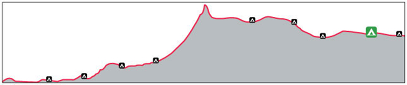
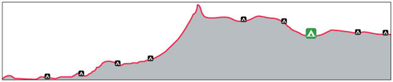
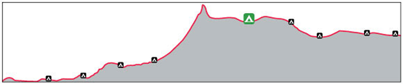
The Chilkoot Trail travels 53 km (33 miles) from Dyea, AK to Bennett City, BC with an elevation gain of over 1000 meters (3500 feet). The Chilkoot Pass (and international border) lie more or less at the halfway point, making for roughly 26 km of trail on the Canadian side. A return trip from Bennett to the Pass coincidentally covers the same distance as the entire Chilkoot Trail, with a lesser elevation gain of 450 meters.
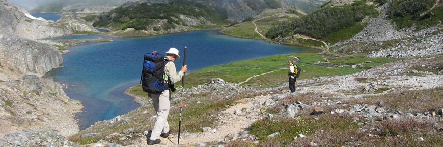
Whether sticking to an overnight at Bennett or hiking towards Chilkoot Pass and back, the Canadian side of the trail promises spectacular hiking.
During the summer hiking season (June 1 through September 13, 2023), every person overnighting in Chilkoot Trail National Historic Site requires a permit. Those without required permits are subject to fines.
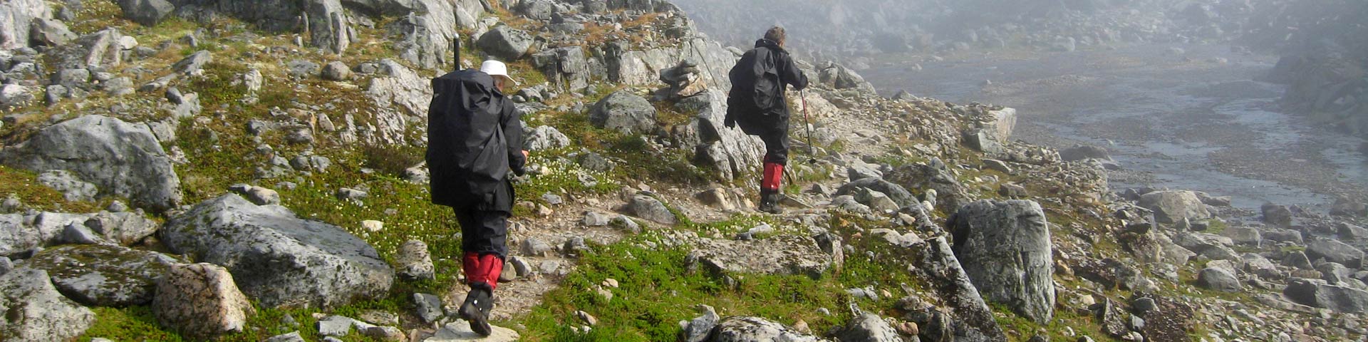
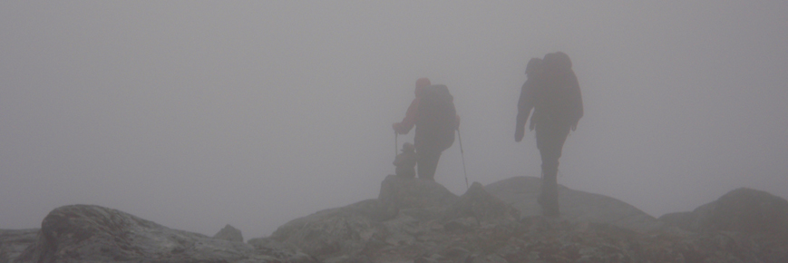
The Chilkoot Trail is a hike for experienced backcountry hikers. Experience in route-finding and navigation are required. Some sections can be more of a route than a trail, visibility is often low to nil due to inclement weather, and snow covered sections should be expected well into July (and sometimes beyond). There are no route markers over snow-covered sections. In low visibility weather, route finding can be especially challenging.
Plan for the weather. Fog, rain, and snow are common, especially at elevation, anytime of year. Learn more about weather and trail hazards to best prepare.You are responsible for your own safety. Know what it means to be self-reliant, and plan accordingly.
There is no telephone or cell phone service along the entirety of the trail, including Bennett. All post-hike travel arrangements must be made prior to starting your hike.
Bennett to Deep Lake
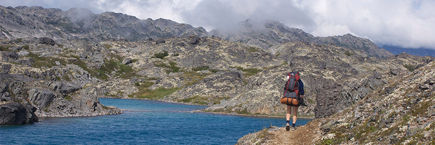
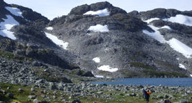
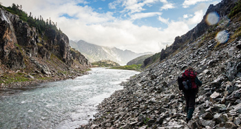
The trail between Bennett and Deep Lake campgrounds is well established, below treeline, and a mix of sand, hard-pack, bedrock, and mud. Stellar views including glimpses of Lindeman Lake and Moose Creek Canyon present themselves along the way. Subalpine boreal forest transitions to alpine tundra as you climb more or less continuously towards Chilkoot Pass.
Deep Lake to Chilkoot Pass
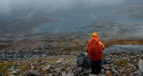
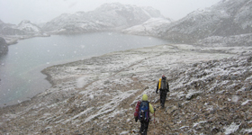
The climb out of Deep Lake meanders above treeline to Long Lake Ridge, where views become wide open, and eventually through Happy Camp Canyon to Happy Camp campground. The trail can be more of a route in this section. Weather can deteriorate, visibility is often reduced, and snow can persist well into the summer. Be prepared to camp on snow at Happy Camp until late June/early July.
Early in the hiking season, plan to travel between Happy Camp and Chilkoot Pass in the early, cooler parts of the day as this section takes you through an avalanche zone. When not covered in snow, the slope to the Pass is talus-covered and requires slow travel as rocks can slip underfoot, and knees can take a beating (especially on the way back down). There is a day-use shelter at the top of Chilkoot Pass making it a logical place for a rest, however, camping is not permitted. Views are spectacular.
Hiking season
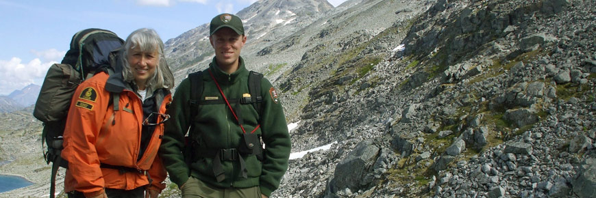
Reservations are required during the summer hiking season (June to mid September). You may encounter Parks Canada and U.S. National Park Service (NPS) staff along the trail during the hiking season, however, while Parks Canada has a staff cabin at Lindeman City, there is no guarantee that someone will be there at a time you may require assistance. Regardless of the season, you are responsible for your own safety and may be expected to pay for rescue/medical costs. You should have international travel insurance that covers these types of expenses.
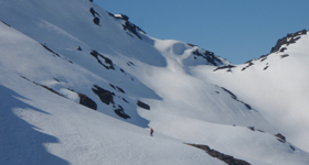
Early June
Winter-like conditions
Chilkoot Pass in early June
Extensive snow travel and route-finding are required. There are no route markers and low visibility conditions are common. While travel conditions may be very difficult, the days are wonderfully long. Winter travel equipment and winter travel experience is strongly recommended. Snow camping is likely. There will be few other hikers on the trail.
Avalanche hazard: During the early hiking season you will want to travel between Happy Camp and Chilkoot Pass early in the day to reduce your exposure in avalanche terrain. Recognize that a return hike from Happy Camp doubles your exposure.
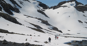
Mid-June to early July
Early season backpackingEarly Summer view of Chilkoot Pass
Expect significant amounts of snow at higher elevations. There are no route markers and low visibility conditions are common. As the season progresses, the snowfields become "punchy" and develop snow/ice bridges over streams and between rocks which can collapse without warning. Travel conditions are highly variable and dependant on weather and time of day.
Avalanche hazard persists until mid-July. During this time you will want to travel between Happy Camp and Chilkoot Pass early in the day to reduce your exposure in avalanche terrain.
Mid-July to early August
Summer backpackingChilkoot Pass in July
The trail/route is generally snow free though some snow patches persist. Travel conditions are highly variable and dependant on weather. Severe rain or snow storms are possible even in the middle of summer.
Peak visitor use occurs during this period. Campgrounds can be crowded.
Mid-August to mid-September
Fall backpackingView from Chilkoot Pass in early September
The trail/route is generally snow free though a few snow patches may still persist.
Fall weather is wetter; fog tends to be more common at elevation; daylight hours are shorter and nights are colder (often below freezing). The colours are turning.
There are generally fewer hikers on the trail at this time of year.
Post season
Mid-September into OctoberHiking in late September
There is no regular patrol presence on the trail and the trail/route is not marked. Up-to-date information on trail conditions is no longer reliably available. Fall weather is wet; daylight hours are short and nights are cold (below freezing). As fall progresses fresh snow becomes increasingly likely. You will need to be self sufficient and accept a high level of responsibility for your own safety. Winter travel experience, route finding, avalanche hazard evaluation and self rescue skills are required.
There are no fees in the off-season, however you must contact Parks Canada in Whitehorse (1-800-661-0486) prior to your trip.
Camping is allowed in designated campgrounds only.
Please note: there is currently no day-use shelter at Happy Camp.
You must specify which campgrounds you will stay at for each night of your trip and how many tent sites you will need when you make your reservation. While this requires careful pre-trip planning, it eliminates over-crowding in campgrounds and ensures that everyone will have a place to camp. Plan for a minimum of two hikers per tent site.
Campgrounds
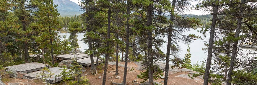
Bennett:
kilometre 0 / mile 0
Bennett Campground
Location & facilities
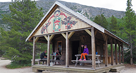
Bennett shelter
Trail mileage: kilometer 0 / mile 0 Elevation: 670 meters / 2200 feet Setting: Forest edge, at river mouth near lakeshore UTM coordinates: 8V 500079 6634157
(NAD 83)
Tent sites: 18 sites, on the ground Cook shelter: Cabin Food storage: Bear lockers.
Description
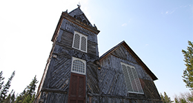
St. Andrew's Presbyterian Church
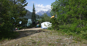
Once a bustling tent city, Bennet is located on the shore of Lake Bennett at the northern terminus of the Chilkoot Trail. Of historic interest is St. Andrew's Presbyterian Church – the last remaining gold rush era building along the Chilkoot Trail. The scenic campground at Bennett is located in what was once the heart of the historic townsite.
Bare Loon Lake
: kilometre 6.4 / mile 3.9
Bare Loon Lake Campground
Location & facilities
Bare Loon shelter
Trail mileage: kilometre 6.4 / mile 3.9 Elevation: 747 meters / 2450 feet Setting: Open forest, on rocky outcrop overlooking lake. UTM coordinates: 8V 497876 6628630
(NAD 83)
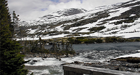
Lindeman City is located in a beautiful, historic setting on the shores of Lindeman Lake. Today’s tranquil ambience stands in stark contrast to the hustle and bustle of 1898 evident from the many artifacts left behind and scattered around Lindeman.
The main base of operations for Parks Canada staff is located at Lower Lindeman, however staff are not there daily.
Deep Lake:
: kilometre 16.1 / mile 10
Deep Lake Campground
Location & facilities
Early season at Deep Lake
Trail mileage: kilometre 16.1 / mile 10 Elevation: 884 meters / 2900 feet Setting: Treeline, overlooking lake near creek mouth UTM coordinates: 8V 492132 6625233
(NAD 83)
Tent sites: 11 sites, wooden platforms and ground sites Cook shelter: No: cooking area with picnic table Food storage: Bear lockers
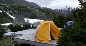
Happy Camp:
kilometre 20.1 / mile 12.5
Happy Camp
Location & facilities
Happy Camp tent sites
Trail mileage: kilometer 20.1 / mile 12.5 Elevation: 899 meters / 2950 feet Setting: Alpine, next to creek UTM coordinates: 8V 490355 6622805
(NAD 83)
Tent sites: 23 sites, wooden platforms. Cook shelter: NO. A cooking and eating platform will be identified for you. Food storage: Bear lockers
Description
On the trail leaving Happy Camp
Happy Camp is the first campground after Chilkoot Pass, making it the most popular destination on “summit day”. Located in the high country, above treeline, the tent sites are exposed and the weather often severe. Spring hikers should be prepared to camp on snow.
From Happy Camp it is 8.8 kilometers / 5.5 miles to Lindeman City; and 13.7 kilometers / 8.5 miles to Bare Loon Lake.
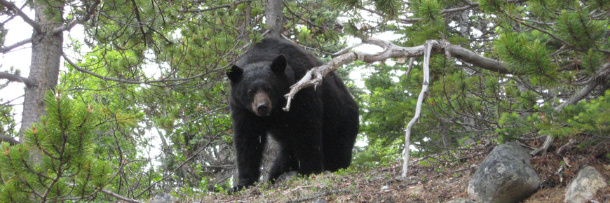
Individual campsites within the campgrounds are available on a first-come, first-serve basis. Open fires are prohibited throughout the national historic site. There are wood stoves available in some shelters below tree line, but wood supplies may be scarce and/or wet. The wood stoves may be closed during times of high/extreme fire weather index. Carry a backpacking cook stove and plenty of fuel. Help keep campgrounds and wildlife safe by cleaning up after yourself, and keeping all your food and other attractants in the onsite bear lockers.
If you plan to take a day-trip within your Chilkoot experience, pack a day-pack with food, water, extra clothing for all weather conditions, bear spray, and the gear you need to be safe and self-reliant.
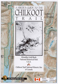
Map: Chilkoot Trail map
Map available for purchase
A Hikers Guide to the Chilkoot Trail
Annotated Chilkoot Trail Map: $9.50 + shipping
Available from Parks Canada - Yukon
Telephone:
1-800-661-0486 (North America toll free)
867-667-3910 (local or overseas)
Hiker safety
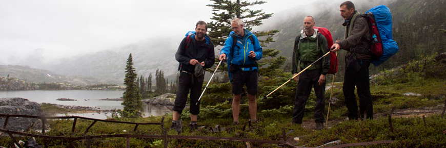
A safe and enjoyable trip on the Chilkoot requires careful planning. You must be well equipped, self sufficient and in good physical condition. Hiking with a partner or small group is preferable.
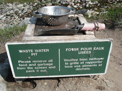
Use wastewater disposal pits, located in all campgrounds and at Chilkoot Pass.
Be sure to clean food waste off the screen and pack it out with your garbage.
Never wash clothes, dishes, or yourself directly in a water source.
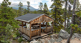
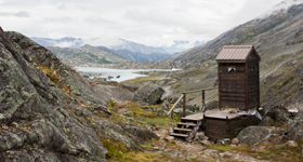
Outhouse at Chilkoot Pass
Human waste
Outhouses are located in all campgrounds and at Chilkoot Pass.
Toilet paper is not supplied on the Canadian side of the trail.
Bring your own!
Pack in - pack out
Nothing should be discarded in the park. You must pack out everything that you pack in.
Bring a garbage bag/container for your garbage and food waste: ziplock-type bags work well
Store all garbage/food waste in the storage lockers with your other attractants
Take all garbage/food waste with you when you leave
Keep your meals simple and light – this will cut down on the weight you carry in and the garbage that you will have to carry out.
Be self-reliant
Chilkoot Trail National Historic Site is a remote wilderness park. Natural hazards are present in the area.
Let someone know your plans. Leave your itinerary, route map and the names of the people in your hiking party with a friend or family member at home, ideally your emergency contact.
Carry Parks Canada’s 24-hour emergency dispatch phone number with you, and leave it with your emergency contact at home. 1-780-852-3100
Carry emergency gear. We recommend extra food, fuel and lighters or matches, a spare set of clothes, and duplicates of your medication etc.
Bring a communication device (InReach, satellite phone, other non-cellular device). There is no cellular service anywhere within the Chilkoot Trail National Historic Site including Bennett.