
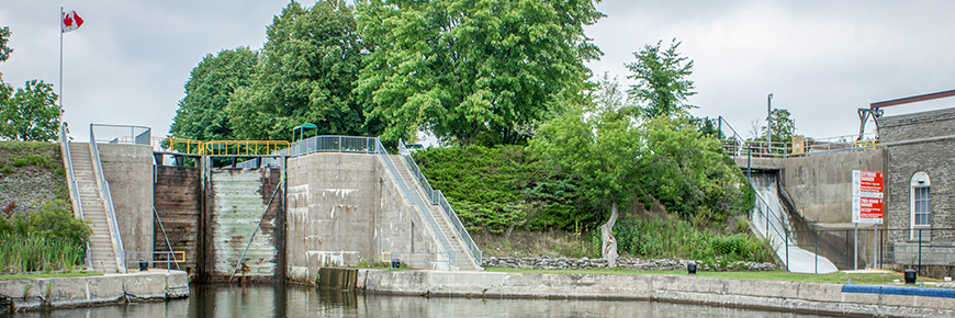
Lock 14 - Crowe Bay
Trent-Severn Waterway National Historic Site
Lock 14 is an island station with pedestrian access by bridge from the east side of the river. The immediate area has a mix of houses and cottages.
Getting here
- Address: 900 County Road 38, Seymour Twp., Ontario
- Nautical chart: #2021 (more on Nautical charts)
- Kilometer marker: 54.2 km (mile 33.7)
- GPS: 44°20'08.9"N 77°46'23.3"W
Hours of Operation
Contact:
- Phone number: (705) 653 - 2040
- Email address: trentsevern@pc.gc.ca
Navigational data
- Lock length: 46.9 m (154 ft)
- Lock width: 9.7 m (32 ft)
- Average lift: 7.6 m (25 ft)
- Max. mooring period: 5 nights
Facilities and services
- Overnight mooring
- Camping
- Washrooms
- Potable water
- Picnic area
- Visitor information
History
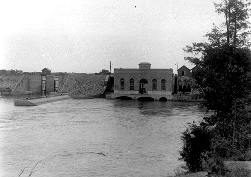
Constructed: 1907-1912
This was the first of the Ontario - Rice Lake section put out to tender with the firm Aylmer & Brown being awarded the contract. Work finished by 1912, but other sections were incomplete so there was no urgency to make the lock operational. Crowe Bay boasts its own bridge to get to the human-made island that has been fully reconstructed with a dam underneath it.
Local tourism
- Trent-Severn Trail Towns (Campbellford)
- Downtown Campbellford
- Trent Hills & District Chamber of Commerce
Phone number: (705) 653-1551 or 1-888-653-1556
- Northumberland Tourism
Phone number: (905) 372-3329 ext 2257 or 2237 or 1-866-401-3278
- Municipality of Trent Hills
Phone number: 1-888-653-1556
- Kawarthas Northumberland
Google Street View
Related links
- Lock 1 - Trenton
- Lock 2 - Sydney
- Lock 3 - Glen Miller
- Lock 4 - Batawa
- Lock 5 - Trent
- Lock 6 - Frankford
- Lock 7 - Glen Ross
- Lock 8 - Percy Reach
- Lock 9 - Meyers
- Lock 10 - Hagues Reach
- Lock 11-12 - Ranney Falls
- Lock 13 - Campbellford
- Lock 15 - Healey Falls
- Lock 16 / 17 - Healey Falls Flight Lock
- Lock 18 - Hastings
- Lock 19 - Scotts Mills
- Lock 20 - Ashburnham
- Lock 21 - Peterborough Lift Lock
- Lock 22 - Nassau Mills
- Lock 23 - Otonabee
- Lock 24 - Douro
- Lock 25 - Sawer Creek
- Lock 26 - Lakefield
- Lock 27 - Young's Point
- Lock 28 - Burleigh Falls
- Lock 30 - Lovesick
- Lock 31 - Buckhorn
- Lock 32 - Bobcaygeon
- Lock 33 - Lindsay
- Lock 34 - Fenelon Falls
- Lock 35 - Rosedale
- Lock 36 - Kirkfield
- Lock 37 - Bolsover
- Lock 38 - Talbot
- Lock 39 - Portage
- Lock 40 - Thorah
- Lock 41 - Gamebridge
- Lock 42 - Couchiching
- Lock 43 - Swift Rapids
- Lock 44 - Big Chute Marine Railway
- Lock 45 - Port Severn
- Date modified :