
Cultural landscapes
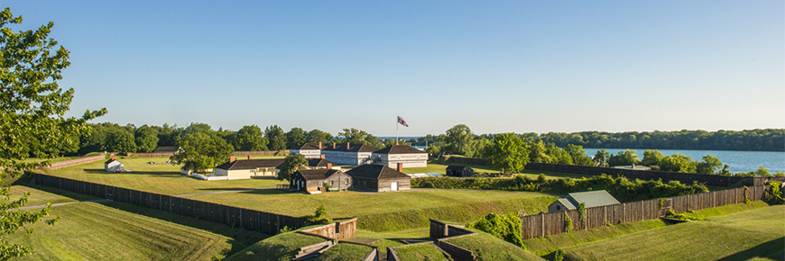
Fort George National Historic Site
Niagara River
The Niagara River connects Lakes Erie and Ontario. For millennia it has served as a highway and as a source of natural resources. Starting with the Indigenous Peoples, people have used it as a highway for transportation and travel, using watercraft such as canoes, boats and ships. Archaeology of Indigenous sites in the Niagara Peninsula has identified numerous objects used for acquiring food from the river and lakes such as harpoon heads, net sinkers, fish hooks, and more.
Early European settlers realized the importance of the Niagara river too, and the river is in essence the entire reason for the location of many fortifications, including those of the Niagara National Historic Sites.
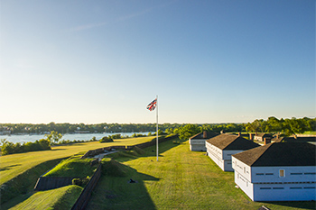
By terms of a 1796 treaty, the British moved their operations to the Canadian bank of the river. Fort George was established to house British troops and their supplies, and to guard the mouth of the river and Navy Hall. By keeping troops at this site on the high ground overlooking the entrance to the river, they hoped to "show the flag" and continue British rule in this part of North America. Likewise, they built the Indian Council House on the Commons to house the operations of the Indian Department charged with keeping good relations between the Army and the Indigenous Peoples who had treaties of alliance with the Crown. Records show that the British Army relied on the river for food for its personnel at Fort George and elsewhere. Soldiers used nets to haul in fish, which they ate once a week.
Navy Hall and Navy Island National Historic Sites were the site of shipyards, docks and warehouses, necessary for the transport of supplies sent to destinations further into the interior of the North American Continent. Queenston was the start of the Portage Road that allowed supplies to be carried in carts around the Niagara Falls, which otherwise blocked river traffic.
When war was declared in 1812, both Britain and the United States developed strategies for attack and defense that used the Niagara River to their advantage. The river was both an obstacle and a route. The outnumbered British could use the river as a defensive line, but the United States forces could also use it to move troops and supplies to their own advantage. Unlike on the Great Lakes, where both sides built fleets of warships for combat and transport, the river was contested from the land. Only boats and smaller watercraft could be maneuvered to any advantage in the fast flowing current, but they would at all times be vulnerable to artillery placed on either side of the river.
At the Battle of Queenston Heights, the Americans planned to cross the river using boats and bring their army into Canada. The fragile boats had to contend with swift, alternating currents in the river as well as British artillery at the Redan Battery above the village of Queenstown, which could destroy their boats as they transported the men.
The Niagara Escarpment
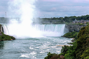
The Escarpment dominates the landscape in the Niagara region, and produces the Niagara Falls which has long been a transportation challenge, a natural wonder, and a tourist destination. But in the War of 1812, its heights also provided an advantage to defenders and a challenge to attackers. During the war, several places on either bank of the Niagara River were the location of fortifications of several types. There were redoubts, such as Fort Drummond at Queenston Heights, which were small forts where soldiers were stationed to keep watch for the enemy and to form a first line of defence against an invasion of either river bank. There were also batteries, or fortifications, designed to provide a protected location for artillery. These were built either for defense of a crossing point over the river, like the Redan Battery or Vrooman's Battery, or for the purpose of bombarding an enemy target, like the American Salt Battery at Youngstown NY, which was built for the express purpose of bombarding Fort George in May 1813. Putting a fortification on the heights of the Escarpment made it more secure from enemy attack, since attackers would have to scale the heights under fire from the defenders to be able to take the position. It gave defenders a clearer field of vision while watching for attackers, as well as a better field of fire for their artillery. The science of military engineering, which designed fortifications and planned operations to take them, was both challenged and aided by the Niagara Escarpment.
The Commons
When the British military surveyed the lands acquired from the Mississaugas through the Niagara Purchase of 1783, the area outside of the town lots of Newark (today's Niagara-on-the-Lake) was designated as a "military reserve.” This tract today is known as the Commons. At different points it has served as a military training ground, a pasture for livestock, and as a recreational nature area.The Great Lakes
The Great Lakes are some of the largest bodies of fresh water in the world and to many they are the "fourth coast" of both Canada and the United States. They are sites of recreation, trade, and industry. In the earlier periods of human history, most trade or travel was done over water, in canoes, boats and ships. In times of conflict, such as the War of 1812, the waterways were critical in any path to victory.
- Date modified :